So lately some of the Bicycle and Pedestrian Advisory Committee (BPAC) folks have been wanting to reevaluate the path and try to make it a shining example of existing bike/ped infrastructure. And it should be noted that while and example of infrastructure....it is currently certainly not shining!
The evaluation is going to be thorough this time around and will look a little something like this (in the vision in my head)....
A participant will be assigned a section of the path and provided a large format plot of the area like this (via google maps):
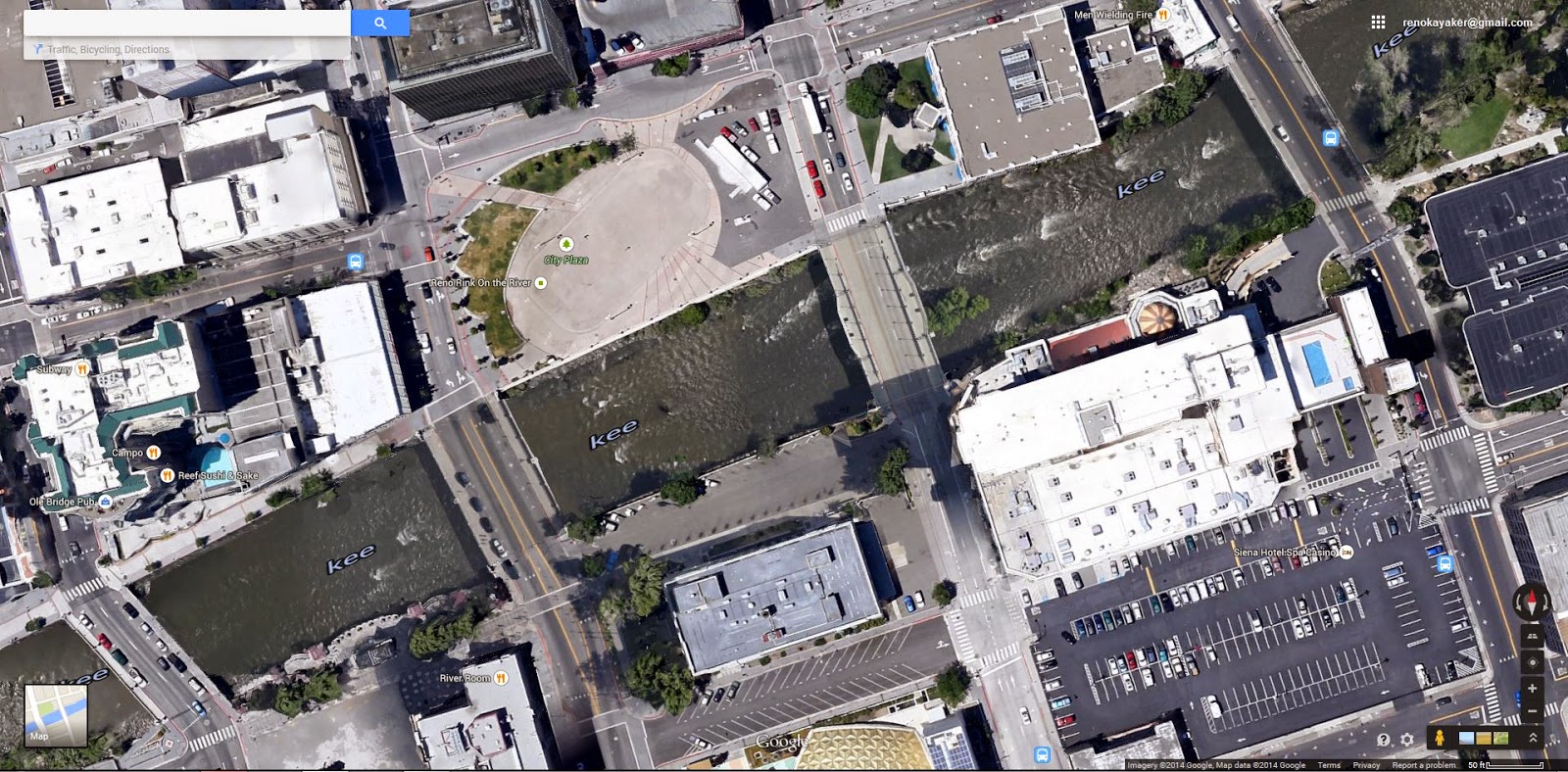
The participant will then ride (or walk) the section evaluating things like path width, pavement condition, associated traffic hazards, general hazards for cycling or walking, etc. The will then mark up their map and add pictures or comments about certain items of concern like this:

So in this case red stars indicate crossing hazards (...that parked cars hinder the view of approaching motorists making crossing the street and increased hazard), line colors are coded to path width (green = greater than 10 ft, blue = 6ft, red = less than 6 ft), and finally the red lightning bolt indicates a walking / cycling hazard.
They can then add pictures to make the issues clearer for the evaluating entity like this:


These two pictures are tied to the red stars, where parked vehicles (in this case RFD!) block motorists from seeing people who are crossing the street at both the pedestrian crossing and the river path.
Another example, this time representing the red lightning bolt:
 |
| Here the path...just terminates at a stairway with little or no warning! |
 |
| Although if you have mad skills there is a ramp you can ride, or at least roll your bike down! |
 |
| Like I said...you better have the skills. And then be able to stop/turn on a dime if you don't want to be in traffic! |
No comments:
Post a Comment